
In 2017, the cost of disasters in the USA alone jumped to $306bn, up from $188bn in 2016. It follows that there is a strong financial and human benefit to being ready to react to such events, minimise loss of life and begin reconstruction. Current emergency communications systems will continue to be used where possible but may themselves be compromised during a disaster. New technology can add to rescue and recovery operations, notably satellite comms, drones, wireless broadband and artificial intelligence (AI).
Understand the risks
Well-developed and tested plans are needed for effective operations. For example, in the UK following the terrorist attacks in London in 2005, the government established clear responsibilities for dealing with this and other emergencies at both national and local levels. A national Emergency Planning College was established to train all types of officers and officials in emergency planning and response.
With clear responsibility established, the agency can determine the level of risk associated with each scenario. It is best to prioritise planning resources for events that are both high-risk/impact and have a high probability of occurring.While terrorism grabs the headlines, the type of emergencies that often have the biggest and most frequent impacts are more likely to be storms and floods. History will identify most of the potential events; for each, response plans can be formulated. These will identify all agencies that need to be involved, particular tasks, and resources. They will also have to include up-front funding to buy equipment, and contingency funds to pay for transport and other costs during an emergency. It is also important to not neglect planning for low-frequency, high-impact events such as pandemics.
Let us examine some of the recent new technologies that complement public service radio systems such as TETRA, P25 and DMR.
The essential processes and systems
Disaster recovery has to assume the complete absence of working infrastructure, and must include search and rescue equipment, mobile generators, shelter, transportation and control tools, and even provisions. The communications system will have to connect rescue officers in the immediate area and then connect back to government and international agencies such as the World Health Organization or the UN. Towers to provide mobile communications and even emergency systems such as P25 or TETRA may well be compromised or destroyed, so the team may be required to establish its own systems.
Verizon in the USA says situational awareness is essential to understand the nature of the disaster, where resources are needed most, and the assets in place and in transit. The development of a common operating picture means that agencies can work together effectively, and the data to assemble this can come from traditional sources as well as new devices such as IoT sensors and drones. At the same time, security should not be neglected – cyber attacks during a disaster could cripple operations. Access to databases needs to be controlled, and there will need to be secure sign-in protocols, especially if cloud services are being used.
Naturally enough, Verizon suggests that LTE is the obvious connectivity solution for disasters. Mobility in terms of voice and data connection is required during emergencies, and LTE provides access to smart applications to build and share the common operating picture, as well as accessing critical information from central databases and sending to the field to assist complex tasks. Verizon can offer deployable networks to backfill for the loss of base stations; cells on wheels (CoW) and cells on light trucks (CoLT) can be quickly moved into the area to connect users using LTE smartphones.
“We offer a priority and pre-emption service free of charge to qualified first-responders, and we’re going beyond those solutions to further extend their LMR networks,” says Steve Miller, national security lead at Verizon Enterprise Solutions.
Public awareness
New technologies and solutions are now making it possible to quickly alert the public to the danger of an emergency and, equally importantly, how to react, such as warning systems using mobile phones. In the USA, the Integrated Public Alert and Warning System (IPAWS) provides alerts using a number of mobile bearers; Wireless Emergency Alerts (WEA) are sent to public mobile phone operators and on to their users. Trevor Drawbridge from SEEMS Global describes a system it is developing to receive low Earth orbit satellite messages from this IPAWS system and to then turn these into an audible message. This can be installed in offices, schools and other public areas to pass on audible warnings. The unit can be plugged into a public address (PA) system if one exists, or it contains its own speaker. Drawbridge emphasises that “using standards-based protocols such as CAP (Common Alerting Protocol) in this case will make interworking far easier”. In Canada, the Alert Ready system will send a tone and text to comparable smartphones as well as to TV and radio [for more on alerting the public at scale, see my article on critical messaging in our last issue – Ed].
When all else fails...
Recipes for disaster
Disaster recovery: come what may
Space to the rescue
The benefits of satellite communications during a disaster are obvious, given the lack of reliance on terrestrial infrastructure. Space-based communications broadly fall into two categories: geostationary satellites and polar orbiting.
Polar orbiting satellites are constantly on the move and so a number of these are needed in a “constellation”, and the range to these satellites permits relatively compact antennas and transmitter/receivers. For example, the Iridium system has found its place as a tool for explorers and emergency teams operating outside of the area of terrestrial communications, or in polar or high-latitude areas. Iridium is being updated with a new constellation of satellites which will offer a workable data as well as voice service. The US deployed 5,000 Iridium phones following Hurricane Maria in Puerto Rico (initially a number of handsets were given to civic leaders but, without being told how to use them, they were not effective).
Geostationary satellites remain in the same position in the sky; in this case, a popular choice for emergency response is the Inmarsat BGAN (Broadband Global Area Network). Small terminals and antennas can connect an isolated control station to the internet to share emails, access databases, upload images and videoconference. The data speeds of up to 384kbps are not as high as LTE and the latest wireless technologies but still provide a workable service when other communications are not available. Another role for satellite communications is as a backhaul for terrestrial systems. For example, AT&T provides service to the FirstNet system in the USA – it can quickly deploy an emergency band 14 LTE network which will be connected to control centres and other users using satellite links.
Remote sensors and IoT
For some time, sensors have been able to give early warning of events such as tsunamis and volcanic activity. However, many natural disasters occur in developing countries where infrastructure is limited, as was the case in Indonesia and Thailand in 2004. The careful selection and siting of sensors may significantly limit loss of life and the cost of recovery. These could be seismic or microwave devices to detect earthquakes or landslips, temperature or CO/CO2 to detect fires, and water-level sensors to warn of floods. Providing backhaul to sensors in very remote areas can be done through satellites. Iridium offers Cloudconnect to link static or mobile IoT sensors into Amazon Web Services, and in the context of disaster operations, remote sensors can remain in touch and critical assets such as mobile lifting or medical units can be tracked. Inmarsat offers a similar service.
Drones and airships
Korea Telecom (KT) has developed a combined system using an airship which carries small drones to provide search and rescue communications. At a demonstration featuring a simulated rescue, the airship located the victim, and a local 911 response team was assisted by AR eyewear. Information from the scene was shared with a surgeon, who assessed the health of the patient and recommended remote treatments. The system adds a mobile ground control station, as well as Skyscan, which detects smartphone signals to combine them with a database to provide information on victims and survivors. Skyscan uses a small LTE device to locate survivors with a 50-metre radius, and small drones can then precisely locate them for rescue crews.
Drones can be especially useful in reaching isolated areas when low cloud (or the cost) makes manned aircraft operation impossible. Following the Oso, Washington mudslide in 2014, a drone was used to map the state of the terrain. It is also possible to make use of hobby drones in these situations, but they need to be co-ordinated so as not to interfere with operations, as has sometimes happened.
The role of AI
Can AI anticipate events and speed up response? The Microsoft Azure cloud-based environment includes AI platforms that can monitor weather stations, and seismic and heat sensors on trees to predict storms, earthquakes and forest fires. Early warnings help give the public time to react.
At a local level, IoT sensors can allow controllers to monitor transport, power and buildings to direct resources; AI will lighten the load and provide alternative routes and warnings of failures. Agencies can apply AI and machine learning to data to predict disaster impacts, so they can plan staging areas, evacuation routes and flood areas. Historic data from sources such as the National Oceanic and Atmospheric Administration (NOAA) in the USA have been used to build predictive models for likely flooding areas and the damage that may occur. Could AI be used to predict damage to communications systems during severe weather (loss of towers) or earthquakes and floods (loss of landline links)?
Social media is another promising area for the use of AI. During the Mexico City earthquake of 2017, AI was used to alert volunteers to assist in life-saving activities. Rescue missions were crowdsourced, including requests for items and assistance, which were passed to volunteer groups.
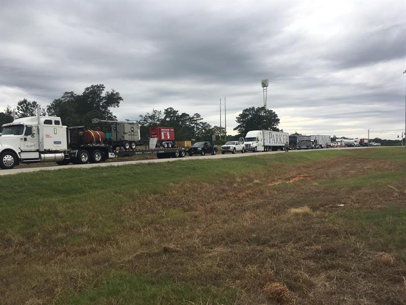
One approach that has been used with some success is pre-staging convoys with the fuel and equipment needed to restore comms outside hurricane-hit areas and have them move in once the storm has passed
Using today’s resources more effectively
Manufacturers of secure communications systems such as P25 and TETRA can make a significant contribution during disasters. Motorola Solutions in North America has response teams that assist public agencies during emergencies, such as during Hurricane Michael in October 2018. As well as hitting Florida, the hurricane moved through Georgia and Alabama, destroying infrastructure including cell towers. Robert Marshall, VP southeast region for Motorola Solutions, says: “We worked closely with state and local authorities to prioritise and co-ordinate repair efforts. As a result, we were immediately able to restore systems that were directly in Hurricane Michael’s path in Lee County, Georgia and Bay County, Florida, including the Tyndall Air Force Base.” Motorola Solutions notes that even though some P25 towers were destroyed, direct mode still connected officers during and after the storm. Manufacturers can assist with the loan of handsets to volunteers, as was the case in Butte County, California in November 2018, when Motorola Solutions supplied 200 P25 radios to response teams dealing with the Camp Fire emergency.
The LTE FirstNet system in the USA has also been assisting during emergencies. As this system is still new to end-users, FirstNet has been working with Texas A&M University and their Disaster City training facility to show how the prioritisation functions work. FirstNet is developing tools to incorporate the service into communications-focused exercises for disasters and emergencies.
Exercises are helping agencies better understand how to use FirstNet during emergencies
Plan, provision, prepare
Knowing the risks is the first step in planning response. These will be different for each nation and region. As an example, the city of Carlisle in the UK had plans to deal with an emergency, but its control centre was rendered useless when the switchgear in the basement was submerged; a history of flooding was not taken into account. Using AI to mine data and assess risks is a promising planning method.


